
Drop the file. Watch it join the city.Data, documents, or both.
Data Management is the front door for your data — upload it once, and every workspace in GUS can use it. Drop spatial files (GeoJSON, Shapefile, coordinate CSV) or documents (PDF, TXT, DOCX, Markdown) into one upload wizard, watch each file move from processing to indexed, then send it straight to Map View, Chat or GUS Consult in a click. Documents get chunked and indexed for retrieval; spatial files become map-ready layers. One library, every tool downstream.
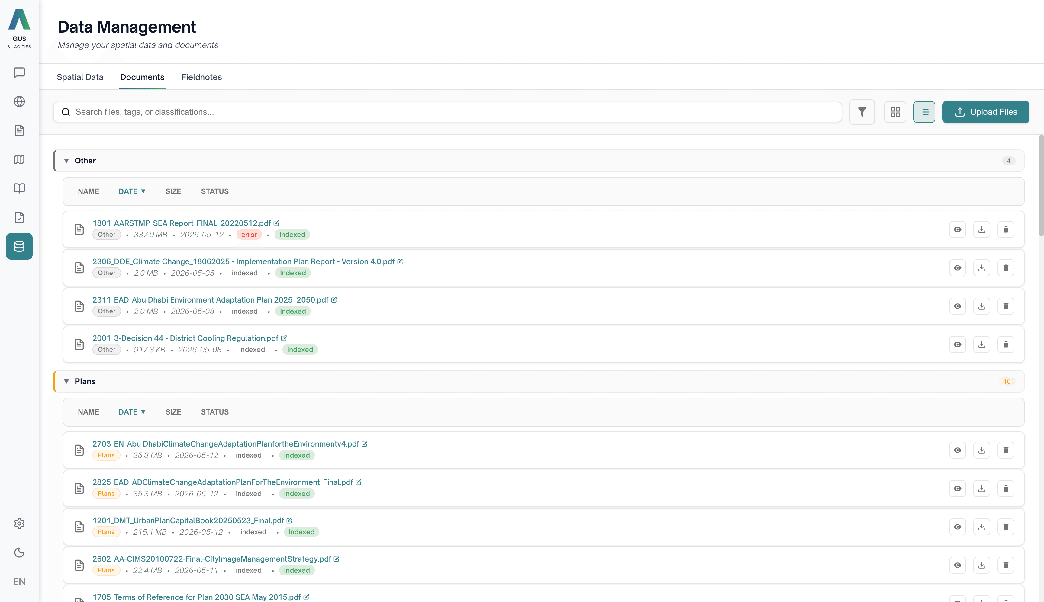
Upload once; every workspace can use it.
Pick a tab
Spatial Data for GeoJSON, Shapefile (zipped) and coordinate CSV. Documents for PDF, TXT, DOCX and Markdown. A third Fieldnotes tab is a shortcut into the Fieldnotes list, not an upload path.
Upload
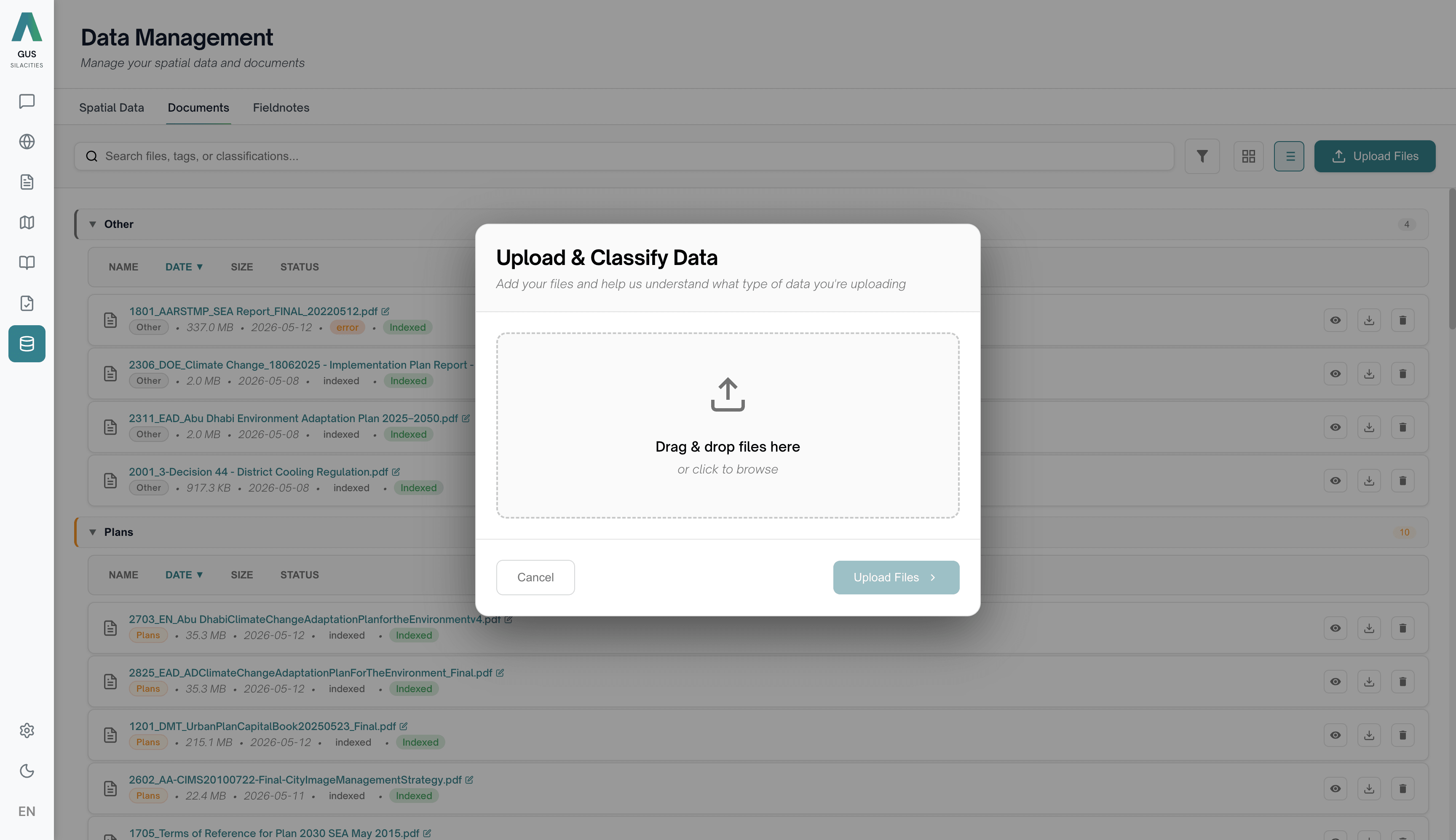
Drag onto the upload zone or click Choose Files. Each file shows its own progress bar. Both spatial and document formats flow through the same wizard, with a classification step for category, date and data type.
Watch it index
Status moves processing → indexed → error. Spatial files write columns for Name, Format, Features, Size, Type, Status, Created. Documents write Pages/Chunks alongside Size, Status, Created. Six summary cards across the top keep the library at a glance.
Hand it over
Spatial Data rows offer Load to Map, Delete, Refresh and Import · one click sends a dataset into Map View as a new layer. Indexed documents appear automatically in GUS Consult Document Chat, Expert Chat and as a GUS Chat source when RAG is enabled.
What Data Management does for the team.
Drop in anything — one wizard sorts it
Spatial Data and Documents share the same drag-and-drop zone and classification step, but land in their own tabs with the columns each type actually needs.
Indexed for every tool
A dataset shows on the Spatial Data tab with Load to Map, Delete, Refresh, Import per row. A document writes its Pages/Chunks count once indexed and becomes searchable in GUS Consult and GUS Chat.
One click to Map View
Send any indexed dataset into Map View in a single click. The workspace opens and the dataset appears as a new layer, ready to style in the Layers panel.
We moved three years of inspection data into GUS in an afternoon. Tagging up front made every downstream question useful from day one.